|
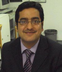
Muhammad Ali Ph.D. Student in C6
Forschungszentrum Jülich 52425 Jülich |
| +49 (0)2461 61 8672 | |
| m.ali@fz-juelich.de | |
SFB/TR32 - Project affiliations
C6 - Process based modelling of regional water and energy fluxes taking into account multi-sensor and multi-scale observation patterns.
MGK - Integrated Research Training Group (IRTG) – all doctoral students
Doctoral research topic
Project start date: 11/2011
Title: Utilization of RapidEye data for improved Hydrological Modelling
Advisor: Prof. Dr. Harry Vereecken
Other doctoral committee members: Prof. Dr. Gunter Menz (Remote Sensing group, Institute of Geography, University of Bonn). Dr. Carsten Montzka.
Scientific interests
- Active and Passive Remote Sensning, GIS
- Hydrological modelling and data assimilation in hydrology
- Improved Evapotranspiration and soil moisture estimation
- Natural Hazards (drought, flood), Tectonic Landforms
Education
2003-04: Post graduate diploma in GIS and remote Sensing. University of peshawar, Pakistan.
2007-11: Master of philosophy (MPhil) in Geology. University of peshawar, Pakistan.
Thesis title: Identifying neo-tectonic features using Lineament Analysis of satellite Images in Tectonically Active Muzaffarabad Area, Kashmir.
Fieldwork / Research assignments
- 1st
- 2nd
- 3rd
- 4th
Appointments
(past jobs)
Professional memberships
- …. Union /
- …. Gesellschaft / Vereinigung
Conference contributions
Author(s), year. Title, Conference name, dates and location, abstract published where?, type of presentation (Poster/Oral presentation)
Publications
Wahab, A., Ali, M,Khan M. A., 2010. Peak-Flood Inundation Map of the Western Peshawar Plain (Peshawar, Charsadda, Nowshera Districts): Implications for Flood Disaster Preparedness Plans. Journal of Himalayan Earth Sciences, Geological Bulletin, University of Peshawar, (Vol. 43).
Khan, J., Ali, M., 2010. Use of GIS in Defining the Management Strategies for Groundwater Resources of Quetta Valley, Pakistan. Journal of Himalayan Earth Sciences, Geological Bulletin, University of Peshawar, (Vol. 43).
Ali, M., Montzka, C., Stadler, A., Vereecken, H., 2013. Validation of Leaf Area Index calculated on RapidEye imagery against in situ measurements in Rur catchment, Germany.In: Borg, Daedelow, Johnson (ed), Proceedings of 5th RESA workshop (From the Basics to the Service), Neustrelitz, Germany, 159-171.
S. Hasan, C. Montzka, H. Bogena, C. Rüdiger, M. Ali and H. Verrecken (2013): Vegetation effects on airborne passive microwave response to soil moisture: A case study for the Rur catchment, Germany. European Geosciences Union General Assembly 2013, Vienna, Austria, 7–12 April 2013.
S. Rudolph, C. von Hebel, M. Ali, A. Stadler, M. Herbst, C. Montzka, S. Pätzold, L. Weihermüller, J. van der Kruk and H. Vereecken (2013): Validation of a paleo river system derived by ground based electromagnetic induction measurements with satellite based RapidEye images. European Geosciences Union General Assembly 2013, Vienna, Austria, 7 – 12 April 2013.
Ali, M., Montzka, C., Stadler, A., Menz, G., Vereecken, H., 2013. Estimation and Validation of Leaf Area Index time series for crops on 5m scale from space. (Manuscript No. 2485 accepted for IGRSS 2013 Melbourne, Australia)
Links


