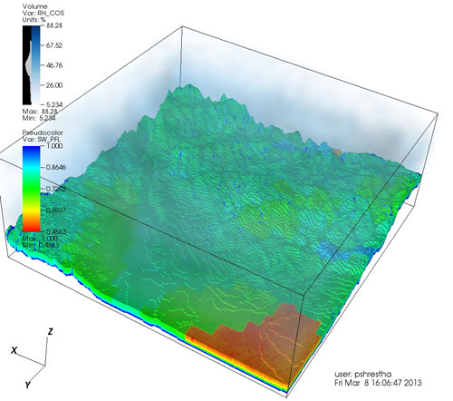
Modelling is one of the three methodological pillars of the TR32 with the aim to better understand patterns and structures in the soil-vegetation-atmosphere system. Modelling activities and developments are coordinated by a central project section (Z4), which developed and currently maintains a physically-based modular simulation platform (TerrSysMP) based on an atmospheric, land surface, and variably saturated groundwater flow component. Improvements and developments from various project sections are integrated in a centralized version of the modelling platform and continuously validated using state variables (e.g., soil moisture) and fluxes (e.g., eddy covariance) retrieved from in-situ, airborne, and satellites measurements in the river Rur basin. This basin is also the TERENO project test bed site of the Eifel/Lower Rhine valley observatory.
Specific modelling activities of the soil-vegetation-atmosphere system which link to the central modelling platform are the implementation of an advanced soil respiration parameterization and the adaptation of a macroscopic root water uptake model (B4); development of crop and cropping models for different land cover types (B5); including a tracer scheme to account for the atmospheric CO2 dynamics in the stomatal control processes at the land surface as well as developing downscaling algorithms to handle different spatial scales between the atmosphere and land surface processes (C4). Finally, model validation and analysis are performed over a range of spatial (from field to catchment) and temporal (from event to multiple years) scales exploiting high performance computing facilities at the Juelich Supercomputing Centre and by promoting a continuous exchange of information and experience between the different project sections.


