Project Data Management and Spatial Data Analyses


Research Area:
Geo-Informatics, Computer Sciences, Remote Sensing, Research Data Management

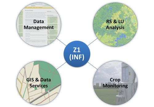
Storage, backup and exchange of all project data is a key issue in interdisciplinary, long-term research projects. Therefore, a main task of Z1 (INF) is to establish a well-organized project data management including project data organization, implementation and maintenance of a system, which also encourages intensive data exchange. The CRC/TR32 data management system (TR32DB) is developed following DFG-guidelines, existing standards, and with regard to user needs. Besides spatially and temporally measured or modeled data, also publications, presentations, reports, and pictures are considered. The TR32DB design is a combination of file management, database, and web-interface including web mapping functionalities. The developed metadata management system guarantees the accurate description of all project data. The TR32DB is hosted at the Regional Computing Centre Cologne and accessible at www.tr32db.uni-koeln.de.
Besides the data management services, Z1 (INF) also provides numerous spatial data services. The main task is the extensive remote sensing (RS) analyses of multi-temporal satellite images to derive accurate annual land use data (LU) and crop rotation information for the Rur catchment. Both are strongly demanded by the CRC/TR32 modeling groups. The land use data have been prepared on an annual basis since 2007. Furthermore, Crop Monitoring (e.g. TLS; UAV) is conducted on CRC/TR32 test sites for multiple years. Moreover, spatial data like topographic, soil, weather data etc. were purchased from various institutions, pre-processed and are continuously provided on demand to the CRC/TR32 participants. All spatial data are available in the TR32DB and most are visualized in an internal TR32DB-WebGIS (login required).
Cooperation partner: